

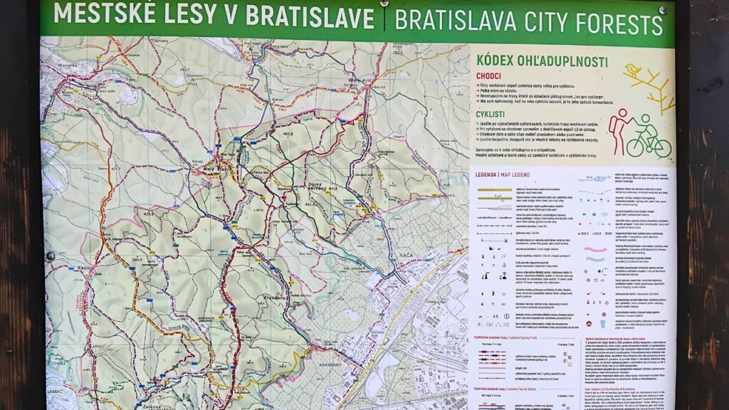
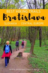
If you live or stay in Bratislava for longer, you might want to explore the green areas in and around the city and spend quality time hiking in nature. This article is an overview of great hiking trails in Bratislava and the surrounding area. Many of these trails are obviously also great for cycling and running. Pick from easy flat trails great for families with children and seniors or more demanding hikes to hilltops, observation towers or castle ruins in the Small Carpathians.
Bratislava has a perfect location. It sits on the Danube river and the first hills of the Small Carpathians that are the westernmost part of the entire Carpathian Mountain Range. There are plenty of forested areas directly in the city of Bratislava where the residents can go hiking.
Before we get any further, get access to my travel freebie library which is a collection of various road trip itineraries, travel checklists and useful travel resources to help you plan your trips and travels.
Table of Contents
HIKING TRAILS IN BRATISLAVA FOR GREAT FAMILY DAY TRIPS
PEČNIANSKY LES (Petržalka District)
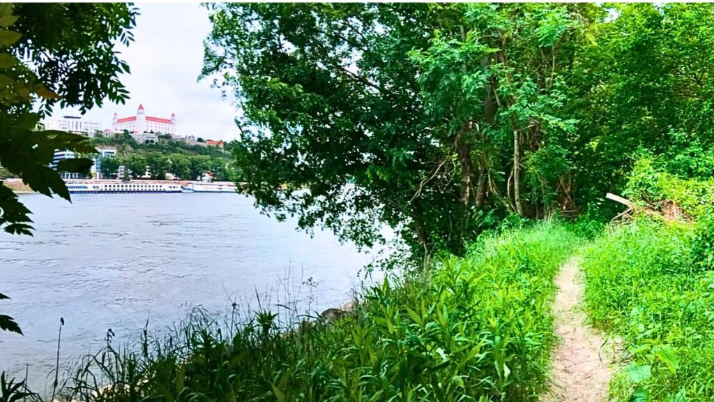
Located on southern bank of the Danube River between the SNP Bridge (aka UFO Bridge) and the Austrian border, Pečniansky Forest is a popular weekend destination for cyclists and hikers. It’s easily accessible with no elevation gain and you can spend 3 to 5 hours of leisurely walking in a lovely forest with many walking paths. Some pathways are only for walking, others for cycling. There are gravel beaches where you can have a picnic.
Despite its present popularity, this forested area used to be a heavily patrolled and prohibited border zone between Czechoslovakia (East Bloc) and Austria (West Bloc). People who tried to cross the border during the times of Iron Curtain were shot dead or caught and imprisoned.
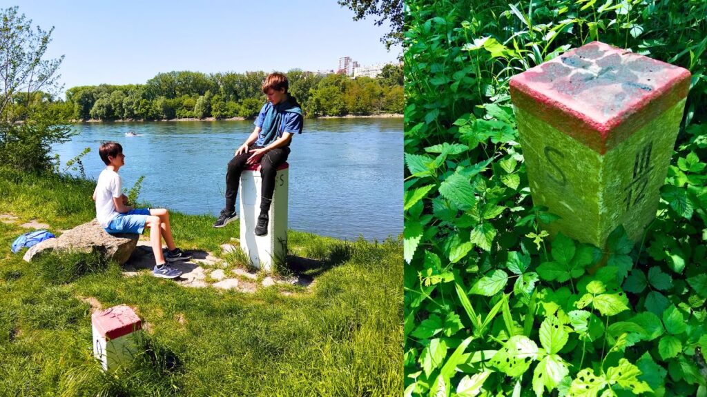
Border stones between Slovakia (S = Slovensko = Slovakia) and Austria (Ö = Österreich = Austria) If you sit on the border stone, you’ll have one leg in Slovakia and one in Austria
If you walk to the Austrian border, take a photo of yourself sitting on the border stone. You’ll have one leg in Slovakia and the other in Austria 😊 Another highlight is the abandoned ruin of the WWII Bunker B-S 1. It’s open and accessible. You can explore it but take a flashlight with you. Be careful as there are deep uncovered openings in the floor you could easily fall into. This bunker is one of several that were built along the border shortly before the WWII.
This little oasis of peace and calm in the bustling city neighbourhood is great for a long family walk with children and grandparents.
Location: southern bank of the Danube River between SNP Bridge (aka UFO Bridge) and the Austrian border
Highlights: Bunker B-S 1
Time needed: approx. 3-5 hours
Distance: 3,7 km from the SNP Bridge to the Austrian border
Elevation gain: 0 metres
Difficulty: Easy, flat trail suitable for families with children and seniors
–>> You might also like to read: HOW TO TRAIN YOUR KIDS TO BECOME HIKERS
CITY PARKS
City parks are a great alternative to more distant forests and they usually come with washrooms, coffee shops, restaurants, playgrounds, fountains, benches and picnic tables for people to enjoy. .City parks are close to residential areas and perfect for short daily walks. Urban parks in Bratislava tend to be busier during summer but not to the point of a nuisance. Additionally, paved pathways are also easier for toddlers, strollers and seniors with walkers. Below are the most popular city parks within Bratislava.
SAD JANKA KRÁĽA (Petržalka District)
Sprawling along the southern bank of the Danube River between SNP Bridge (aka UFO Bridge) and the Old Bridge. It is bordered by the Aupark shopping Mall from the south. Janko Kráľ Park is the oldest public park in Central Europe, and it was established in 1774–1776. It’s a very popular green space for walks and great views of the Old Town and Bratislava Castle. You can enter the park from various points. Aupark Shopping Mall is the best place to park your car also because they offer ľ hours for free.
Sad Janka Kráľa features playgrounds, new skate park directly under the SNP Bridge, quiet areas with benches and long paved walkways. There is also a newly renovated Ferdinand Bistro. For a nice dinner you might want to try Aucafe Restaurant or Leberfinger Restaurant.
Location: southern bank of the Danube River between SNP Bridge (aka UFO Bridge) and the Old Bridge
Highlights: UFO Observation Deck, Ferdinand Bistro, Aucafe Restaurant, Leberfinger Restaurant, Skate Park under the SNP Bridge
Time needed: approx. 1 hour
Distance: 900 metres from the SNP Bridge to the Old Bridge
Elevation gain: 0 metres
Difficulty: Easy, flat trail suitable for families with children and seniors
DEVÍNSKA KOBYLA (Hills between Devín, Devínska Nová Ves and Dúbravka)
Devínska Kobyla is a hilly area between Devín, Devínska Nová Ves and Dúbravka. It’s a favourite hiking destination within the city borders and it features multitude of trails in all directions. Highlights are the Devínska Kobyla Observation Tower overlooking Devín Village and the abandoned Cold War Military Base that occupies the hilltop under the observation tower. It’s an interesting place to explore because it was a secret project between 1970’s and 1990’s and many Bratislavans had no idea such a large army base is located there. There are many bunkers, missile launch pads and barracks.
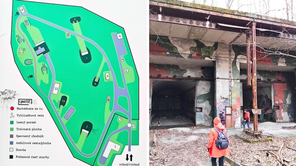
Abandoned Cold War Military Base in Devinska Kobyla
To enjoy this hiking daytrip, start in Devín Village. You can reach the village with the bus line #29 from the SNP Bridge bus stop. It’s about 25 minutes to Cyril and Metod bus stop. Then go to the nearby Holy Cross Church where the red marked trail to the Observation Tower starts.
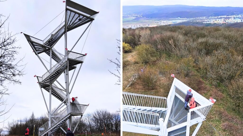
Devinska Kobyla Observation Tower – 112 steps to reach the top platform at 21.27 metres. ArchDaily included this lookout tower on their 25 architectural lookout tower list.
Follow the red marked trail to the top of the hill and enjoy the amazing panoramic views to Austria and the Small Carpathians. You can explore the military base at the foot of the tower and then follow paved road downhill to Dúbravka. In Dúbravka, get to the Žatevná bus stop and take bus line 83 to downtown Bratislava in about 30 minutes.
Location: Devínska Kobyla Hills between Devín Village and Dúbravka District
Highlights: Devinska Kobyla Observation Tower, abandoned Cold War Military Base
Time needed: approx. 3-5 hours
Distance: 5,4 km Devín to Observation Tower + 3,7 km Observation Tower to Dúbravka
Elevation gain: 360 metres
Difficulty: Moderate trail suitable for families with children and fit seniors
Planning a trip to Slovakia? Don’t know where to start? Take the stress out of trip planning and let me plan your perfect custom trip itinerary anywhere in Slovakia.
GREAT HIKING DESTINATIONS NEAR BRATISLAVA
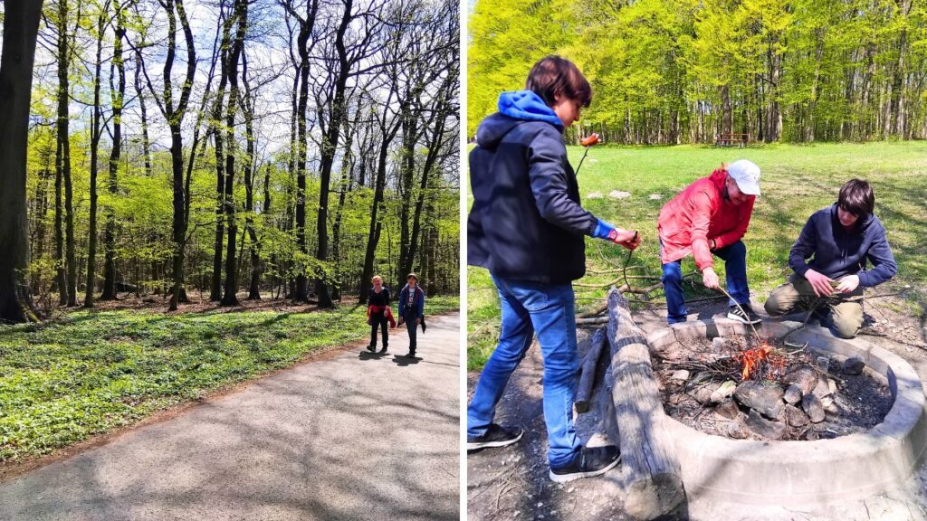
Our favourite hiking trails in Bratislava are in the Small Carpathians because they offer longer trails for nice weekend trips with family and friends. They are not too far, all within 20 minutes of driving or bus riding. We always take a backpack with water and food so we can enjoy lunch picnics. Here is a list of our favourite hiking trails outside Bratislava.
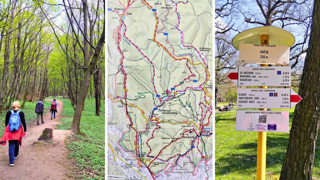
PATRÓNKA TO MARIANKA VILLAGE VIA KAČÍN HILL
A great trail for a half-day hiking trip in nature. Starting point is from the Patrónka Bus Stop and nearby Železná studienka. Then take the red marked trail that goes along the Železná studienkaTrain Station towards Kačín Hill. The trail takes you to Klanec and Jurčekova lúka (meadow) where you can stop for a lunch picnic. Then continue north to Kačín Hill in direction of Marianka Village.
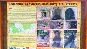
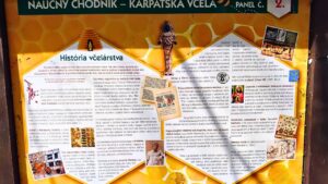
This trail is named after a notable local hiking trail marker: Jurko Szomolanyi Trail. Along the trail that leads you through a lovely, lush forest you will come across playgrounds for children, information boards about bees and underground WWI fortifications. Follow the red trail to Marianka Village where you can stop by for a refreshment in Hostinec U zeleného stromu. We enjoyed their strudel with coffee.
To get back to Bratislava, take the bus line 215 that takes you to Patrónka Bus Stop in 20 minutes.
Location: Bratislava City Forest between Železná studienka and Marianka Village
Highlights: Jurčekova lúka picnic, lovely, lush forest
Time needed: approx. 3 hours
Distance: 12 km
Elevation gain: approx.150 metres
Difficulty: Easy trail suitable for families with children and fit seniors
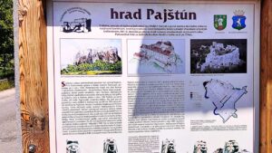
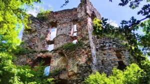
PAJŠTÚN CASTLE RUIN (Borinka District)
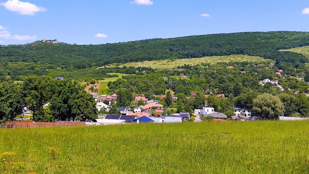
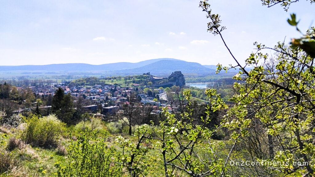
Borinka Village with Pajštún Castle ruin in the distance
A great tip for a hiking daytrip trail in amazing nature with stunning views is the Pajštún Castle hike.
Starting point is in Marianka Village. It’s easier to go there by using public transportation because it’s a round trip and you don’t return to the same spot. To get to Marianka Village, take bus line 215 from Patrónka Bus Stop to the last bus stop in Marianka Village. The ride takes 20 minutes. From Marianka follow the trail to Borinka Village which is about 3 km long and you need around 50 minutes of time to cross the peaceful, lovely forest.
Then from Borinka Municipal Office near the church head up towards the Pajštún Castle which can be seen from the distance. This part of the trail between Borinka Village and the castle is the hardest part because the trail is rather steep. It’s approx. 2 km long.
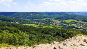
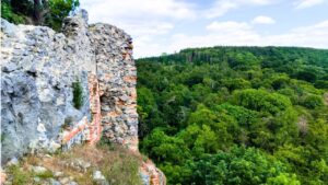
When you reach the Pajštún Castle, stay a while, have lunch on one of the benches or spread a blanket on the grass and enjoy the amazing views into the forested hills of the Small Carpathians. After a relaxing break, walk around and explore the ruins.
Pajštún Castle served as a watch point during the medieval times and as a residence for various local noble families. Then during the Napoleonic wars, the destructive French army detonated the castle which at that time was already uninhabited due to a previous fire damage. From that unfortunate moment, the castle deteriorated to the present state. In the recent years, the castle enthusiasts put effort into castle restorations and this castle saw some wall repairs, too.
In addition to being a popular hiking destination for locals, climbers also love to train on the steep rock wall under the castle.
To get back to Bratislava, follow the downhill trail to Stupava. The trail is approx. 4,5 km long and will take you about an hour to reach a bus stop in Stupava.
From Stupava Village, take the bus line 269, 219 or 245 to Patrónka Bus Stop in Bratislava which takes around 25 minutes.
Location: Bratislava City Forest between Marianka Village, Borinka Village and Stupava
Highlights: stunning views from the Pajštún Castle hill, walk through a lovely forest
Time needed: approx. 5-6 hours
Distance: 16 km
Elevation gain: approx. 210 metres
Difficulty: Moderate trail suitable for families with children and fit seniors
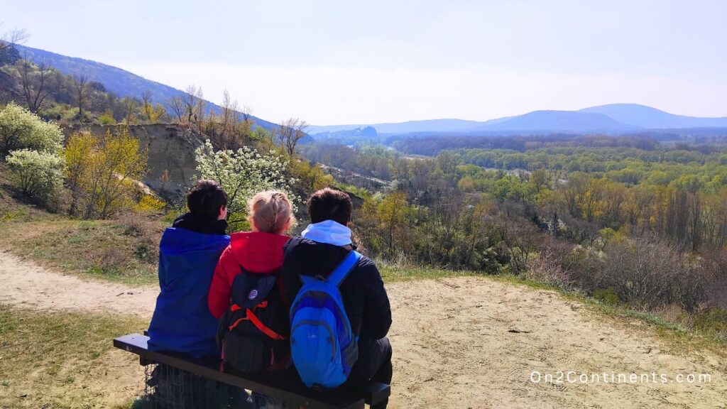
SANDBERG TO DEVIN (Devinska Nova Ves District to Devin District)
On thsis hike you will enjoy a great view of the Devin Castle in the distance
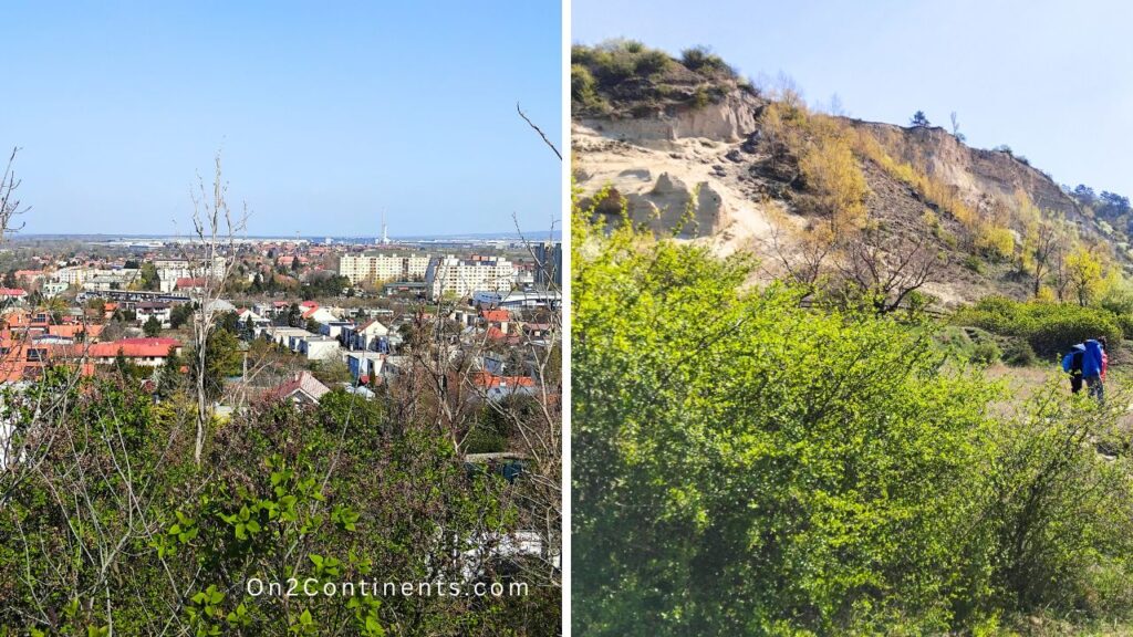
A great trail for a quick walk within the city borders. Favourite with the locals on weekends. It will take you from Devinska Nova Ves village to Devin village along the Sandberg and Devinska Kobyla hills overlooking the Morava river.
Devin Castle in the distance
This trail takes you from point A to point B, so it’s not practical to get to the trailhead by car. I suggest you take the public transportation. Take the bus #21 in the direction of Devinska Nova Ves and get off at Milana Marečka bus stop. Then walk uphill the Pod Lipovým street and at the end of the street you enter the forest. Walk towards Sandberg and join the blue marked trail.
Devinska Nova Ves and Sandberg
The trail runs along the Devinska Kobyla hill as well as the Morava river below. You will also enjoy the views of the medieval Devin Castle in the distance.
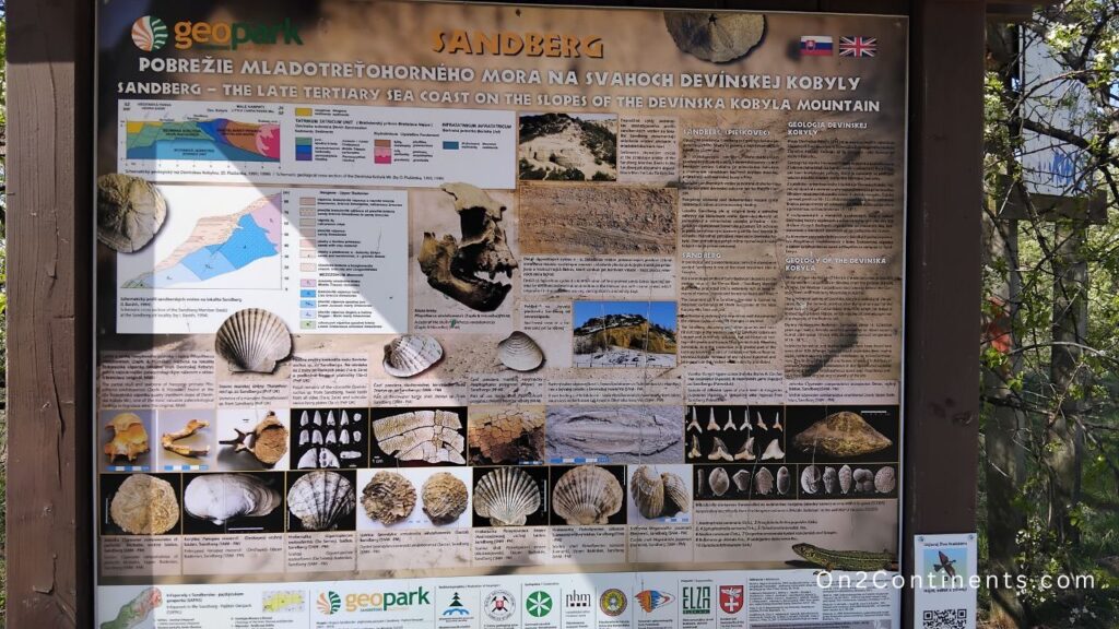
Sandberg area is an interesting place as well. It’s a high-degree protected natural area due to archeological finds from ancient times and prehistoric seabed. Make sure you don’t bring your bike on this trail and your dog must bea on leash. Also, stay on the trail and don’t climb the sandstone hills. Fines can be high.
When you reach Devin, you can either explore the village or the Devin Castle, go for lunch or take a bus #29 back to the city. This trail is an easy one, recommended as a quick walk in the nature without going too far out of the city. Small children and seniors will also manage without problems. The elevation is mild and gradual of around 200 to 400 metres and the trail surface is quite flat with lovely flora along the path. If you have good eyes and the season is right, you might spot some wild orchids.
Location: Devinska Nova Ves District to Devin District
Highlights: stunning views from the Devin Castle, Danube and Morava rivers as well as Austria across the border
Time needed: approx. 1-2 hours
Distance: approx. 4 km
Elevation gain: approx. 200 -400 metres
Difficulty: Easy, mostly flat trail suitable for families with children and fit seniors
HAINBURG CASTLE AND BRAUNSBERG HILL (Austria)
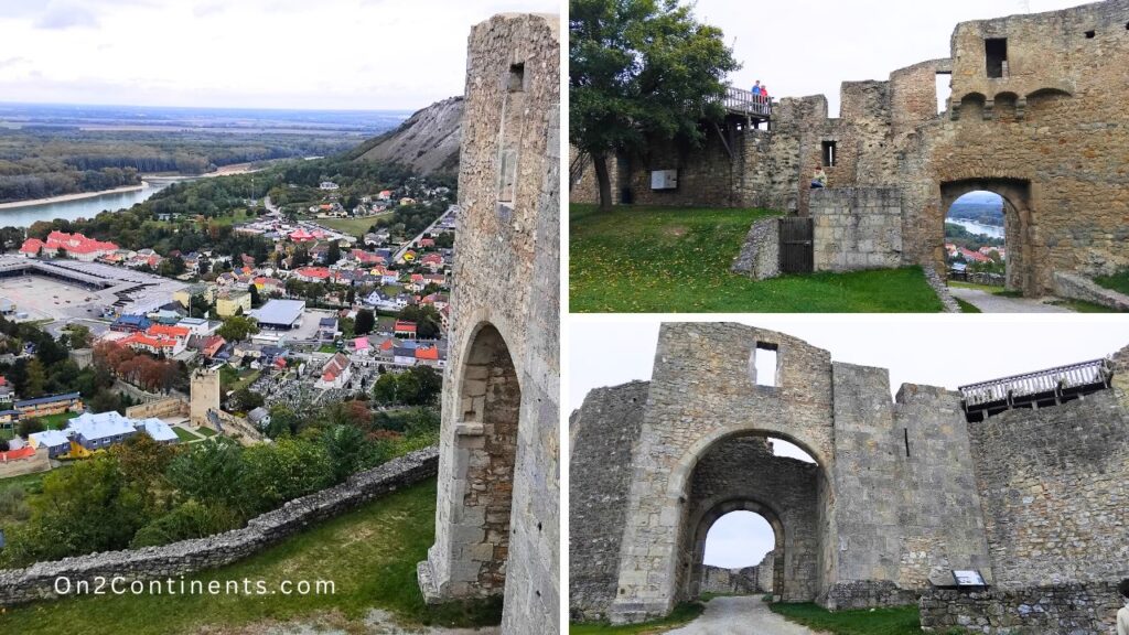
Hainburg Castle in Austria
Location: Hainburg an der Donau, Austria
Highlights: stunning views from the Hainburg Castle overlooking the Danube river as well as Bratislava and Slovakia across the border
Time needed: approx. 1-2 hours
Distance: approx. 4 km
Elevation gain: approx. 200 -400 metres
Difficulty: Easy, paved uphill path suitable for families with children and fit seniors
I hope this guide to the best hiking, cycling and running trails in and near Bratislava, Slovakia was useful, and you share it with your friends. Also, check out and subscribe to On2Continents video channel.
Bookmark this article now, read later
This post may contain compensated links. All purchases or bookings you make through this blog come at no extra cost to you. More details in Privacy Policy & Disclosure.